PROJECT eNiGMA
Next Generation Maritime Archaeology
Project eNiGMA is an initiative of the Hellenic Archaeological Exploration Society (HAES) supported by Ilios Remote Sensing to bring advanced underwater imaging, robotics, and three-dimensional reality-capture technologies to maritime archaeology.
The objective is to expand the tools available to archaeologists for discovering, documenting, studying, and monitoring submerged cultural heritage—particularly at depths and in environments where conventional diver-based investigation becomes difficult, expensive, or impossible.
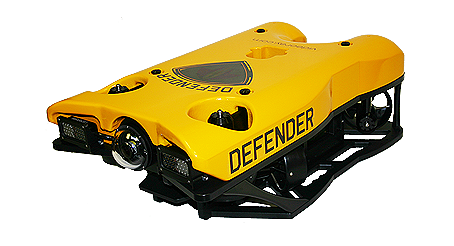
By combining remotely operated vehicles (ROVs), underwater imaging, sonar, and high-resolution three-dimensional scanning technologies, Project eNiGMA seeks to help archaeological teams investigate underwater sites while minimizing physical disturbance to the archaeological record.
Explore deeper. Document more. Disturb less.
Hellenic Archaeological Exploration Society
Supporting Archaeology, Science, and Cultural Heritage
The Hellenic Archaeological Exploration Society is a nonprofit organization based in Washington State with a corresponding non-profit AMKE in Greece and is an AHEPA national project. Project eNiGMA operates within HAES's broader mission of supporting archaeological exploration, scientific research, technological innovation, and cultural-heritage preservation.
Ilios Remote Sensing supports HAES by contributing reality-capture expertise, equipment, technical development, and project support. This relationship allows technology and experience developed through commercial work to be applied to scientific and archaeological projects that might otherwise have limited access to specialized technology.
The Mentor Shipwreck
Connecting New Technology With Active Archaeological Research
The wreck of the brig Mentor provides an important connection between Project eNiGMA and active underwater archaeology in Greece. The Mentor sank off Kythera in 1802 while transporting part of the collection removed from the Parthenon and other monuments of Athens by agents of Lord Elgin.
Archaeological investigation of the wreck has continued under Greece's Ephorate of Underwater Antiquities, providing new information about the vessel, its cargo, passengers, and the circumstances surrounding its loss.
In 2023, members of the team behind Project eNiGMA participated in the Mentor expedition. The Hellenic Archaeological Exploration Society also financed and produced the following documentary about the ongoing archaeological excavation.
Why Use an ROV?
Extending Archaeological Investigation Beyond Diving Limits
Divers remain essential to underwater archaeology, but human physiology imposes unavoidable limits. As depth increases, bottom time decreases while decompression requirements, risk, logistical complexity, and cost increase. Visibility can be poor, sites can cover large areas, and some archaeological remains lie beyond practical diving depths.An appropriately equipped ROV can remain at depth for extended periods without exposing a person to those risks. ROVs can:
Conduct preliminary site surveys
Search large areas
Inspect potential archaeological targets
Record high-resolution video and imagery
Carry sonar and other sensors
Collect repeatable observations
Return to precise areas of interest
Support archaeological divers before, during, and after an excavation
Investigate depths beyond practical archaeological diving operations
The goal is not divers versus robots. It is to use each where it provides the greatest value.
Supporting Archaeological Research
Technology in the Service of Greece's Cultural Heritage
Greece possesses one of the world's richest underwater archaeological landscapes. Thousands of years of maritime activity have left shipwrecks, submerged settlements, ports, anchorages, aircraft, and other cultural remains beneath Greek waters.
Responsibility for investigating and protecting this heritage rests with the Greek Ministry of Culture and its Ephorate of Underwater Antiquities.
Project eNiGMA seeks to support the responsible archaeological authorities, universities, and researchers by providing access to advanced technical capabilities.
Archaeologists define the research objectives and retain responsibility for the archaeological work and resulting data. HAES and Ilios Remote Sensing contribute technology, equipment, technical expertise, data acquisition, and processing where these capabilities can enhance the research.
This is the collaborative approach we use at Aigai in support of archaeological research conducted by Aristotle University of Thessaloniki.
Our role increase the data used by archaeologists in their research.
Underwater 3D Documentation
Creating Measurable Digital Records Beneath the Surface
Photography and video are invaluable tools in underwater archaeology, but they primarily record appearance. Three-dimensional reality capture adds measurable geometry. Underwater scanning technologies can create detailed 3D records of archaeological features, shipwreck components, artifacts, seabed conditions, and their spatial relationships. Depending on the technology and conditions, these datasets can support:
Archaeological documentation
Dimensional measurement
Site mapping
Artifact location and spatial relationships
Structural analysis
Baseline condition records
Monitoring change over time
Research and interpretation
Digital preservation
3D visualization
Museum and educational applications
A comprehensive digital record also allows researchers to revisit the site virtually after an expedition has ended.
Capture the site once. Continue studying it long after leaving the water.
Underwater Laser Scanning
Bringing Precision Measurement
to Submerged Cultural Heritage
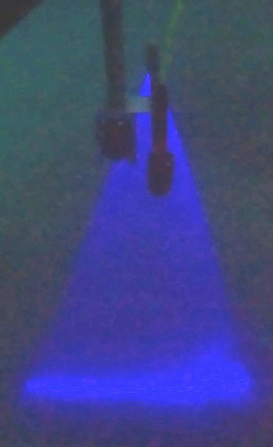
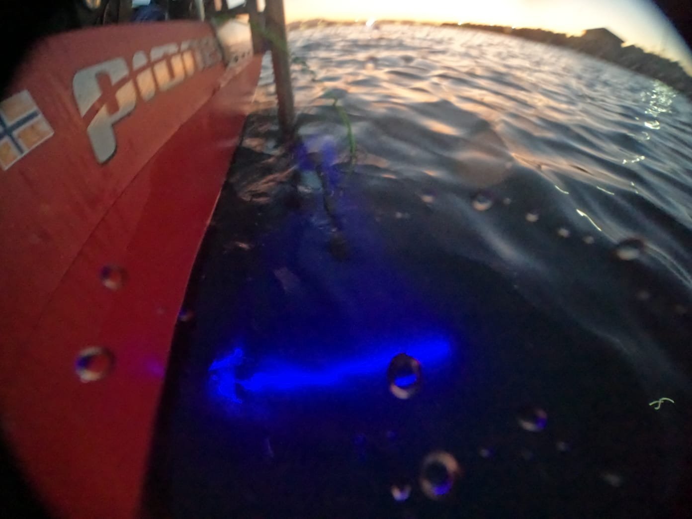
One of Project eNiGMA's principal technical objectives is integrating high-resolution underwater laser scanning with an ROV platform suitable for archaeological research. Underwater cultural heritage extends far beyond shipwrecks.
Submerged settlements, ancient harbor installations, architectural remains, roads, walls, foundations, and other archaeological features can cover large areas of the seabed. Sites such as Pavlopetri and the submerged remains at ancient Epidaurus demonstrate the extraordinary range of cultural heritage that survives beneath Greek waters.
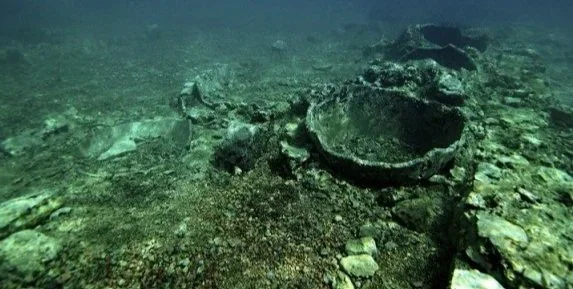
Underwater laser scanning offers the potential to document these sites rapidly and safely while acquiring highly detailed, measurable geometry without requiring physical contact. For submerged settlements and archaeological landscapes, scanning can document walls, foundations, streets, buildings, harbor works, and the spatial relationships between features across a larger site. For shipwrecks, the same technology can capture hull remains, timbers, machinery, cargo, anchors, amphorae, weapons, and other surviving features.
The technology is not limited to documenting individual objects. It can help preserve the geometry and spatial relationships of an entire archaeological landscape.
Copyright ISCR
Protected & Difficult-to-Access Sites
Documenting Places Where Access Is Limited
Some underwater archaeological sites are subject to restrictions on recreational diving in order to protect the cultural heritage they contain.
With appropriate authorization and archaeological supervision, remotely operated systems offer another means of investigating and digitally documenting such sites while maintaining controlled physical access to the archaeological resource.
An ROV can potentially remain on site for extended periods without exposing divers to unnecessary risk or requiring extensive diver time on the seabed.
This capability may be particularly useful for large submerged settlements, deep sites, environmentally challenging locations, and protected archaeological areas where conventional access is limited.
Protected does not have to mean undocumented.
Non-Invasive Archaeology
Document More. Disturb Less.
One of the greatest advantages of remote-sensing technology is the ability to collect information while minimizing physical disturbance to an archaeological site.
An ROV can inspect a site without putting a diver on the seabed. Sonar can identify features before excavation. Cameras can document objects without moving them. Three-dimensional scanning can measure structures and artifacts without touching them.
These technologies cannot answer every archaeological question, and excavation will sometimes remain necessary. But when useful information can be collected without disturbing the archaeological record, non-invasive documentation should be part of the archaeological toolkit.
From Discovery to Digital Preservation
A Digital Record Can Have a Life Far Beyond the Expedition
An underwater expedition may last days or weeks. The data collected during it can remain useful for decades.
Detailed 3D datasets can support archaeological research, conservation planning, academic collaboration, public interpretation, museum exhibits, education, and future comparison. Researchers who were never present during the original expedition can potentially examine the digital record. Students can explore sites that would otherwise be inaccessible. Museums can introduce visitors to archaeological sites that remain beneath the sea. And future archaeologists can compare the condition of a site with a record created years or decades earlier.
The expedition ends. The digital twin remains.
Monitoring Change Over Time
A Baseline for the Future
A detailed three-dimensional scan does more than document what exists today. It can establish a measurable baseline against which future conditions can be compared. Repeating scans over time introduces the fourth dimention: time. Returning to a site and comparing new measurements with an earlier dataset may help researchers identify deterioration, sediment movement, structural changes, biological effects, erosion, or human disturbance.
This creates the possibility of monitoring submerged cultural heritage without relying solely on visual observations.
Document the site today. Measure how it changes tomorrow.
Bringing Underwater Archaeology to the Public
Explore Sites That Cannot Be Visited
Some of the world's most fascinating cultural heritage lies beneath the water and is physically inaccessible to almost everyone. 3D models, photogrammetry, video, sonar imagery, and other digital products can help bridge that gap. Data originally collected for scientific documentation can also support museum exhibits, educational material, interactive experiences, documentaries, and digital reconstructions.
Students can explore archaeological sites they could never physically visit. Museums can bring submerged cultural heritage into their exhibits. Researchers can share discoveries with audiences around the world.
The same technology that helps archaeologists study submerged cultural heritage can help the public understand why it is worth protecting.
Archaeology Requires More Than One Discipline
Collaboration Is Central to Project eNiGMA
Modern underwater archaeological research draws upon expertise from multiple disciplines.
Archaeologists provide historical context, research questions, excavation methodology, and interpretation.
Hydrographers and surveyors provide positioning and mapping.
ROV operators provide access to difficult environments.
Engineers integrate platforms and sensors.
Imaging and reality-capture specialists create detailed digital records.
Marine scientists contribute knowledge of the underwater environment.
Project eNiGMA seeks to bring these capabilities together in support of archaeological research.
The objective is not technology for technology's sake. It is better archaeology through appropriate technology.
Commercial Technology Supporting Cultural Heritage
Ilios Remote Sensing provides technical expertise, equipment, and reality-capture capabilities in support of HAES projects. This relationship allows technologies and experience developed through commercial work to be applied to archaeological and scientific research. At the same time, archaeological projects challenge us to apply reality-capture technology in demanding environments—from active excavations and historic structures to shipwrecks and submerged archaeological sites.
Commercial experience provides the capability. Cultural heritage gives us an opportunity to put that capability to work preserving the past.
From Aigai to the Seafloor
One Partnership. Two Environments.
The collaboration between Ilios Remote Sensing and HAES extends across both terrestrial and underwater archaeology.
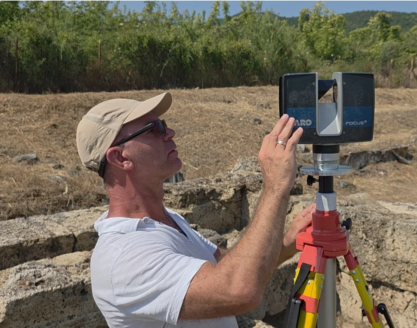
At Aigai, Ilios Remote Sensing, HAES, and our technical partners support archaeological research conducted by Aristotle University of Thessaloniki using terrestrial laser scanning to create detailed three-dimensional documentation of an active excavation.
Through Project eNiGMA, that same philosophy is being extended beneath the water: use appropriate reality-capture technology to help archaeologists document cultural heritage with greater precision while minimizing unnecessary disturbance.
On land or underwater, the principle is the same: technology should serve the archaeology.
Support Project eNiGMA
Help Bring Advanced Technology to Underwater Archaeology
Developing and deploying advanced underwater technology requires equipment, engineering, vessel time, logistics, technical expertise, and funding.
Organizations and individuals can support Project eNiGMA through technical collaboration, equipment, engineering expertise, research partnerships, sponsorship, and financial support through the Hellenic Archaeological Exploration Society.
If your organization works in marine robotics, underwater imaging, sonar, positioning, 3D scanning, ocean engineering, archaeology, or related technologies and would like to contribute to the project, we would like to hear from you.
Help us bring the next generation of technology to the exploration and preservation of underwater cultural heritage.